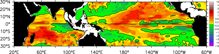
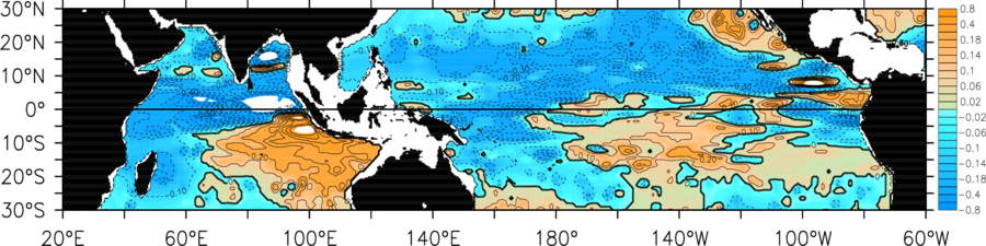
Anomaly defined relative to Jan 2004 - Dec 2016 RG Argo Climatology annual cycle
[Roemmich, D., and J. Gilson, 2009. The 2004-2008 mean and annual cycle of temperature, salinity, and steric height in the global ocean from the Argo Program, Progress in Oceanography, 82, 81-100.]
Utilized Argo data spans 10 days centered at
December 2, 2019 0: 0: 1
GMT